GRTC Pulse
The Greater Richmond Transit Company, commonly known as GRTC, is one of the oldest transit companies in the United States. Through the decades, GRTC has had to adapt to the myriad of rapid technological, geographical and demographic changes in the Richmond area. In 2018, they expanded and improved their systems once again by introducing the first Bus Rapid Transit Line called GRTC Pulse. This division was created to specialize in transport that would operate faster than traditional buses, running every 15 to 30 minutes. GRTC needed new maps to include as a vital part of their larger communications plan during the Pulse unveiling. So, they returned to Red Orange for guidance on how to visually convey the massive changes to their existing maps while integrating Pulse bus routes so GRTC riders could easily understand the changes.
Creative Services
Print Design
Map Design
Collaborative Approach
The communicative and structured dynamic between the Red Orange and GRTC scheduling teams worked well during this fast paced and complex project. While Red Orange and GRTC have worked together in past years to update their existing routes and time tables, the addition of the Pulse transit line and creation of new maps required even closer collaboration. Design and scheduling changes had to be quickly executed while the newest routes were being finalized. Working as partners, we tackled the many intricacies of creating the new maps using clear communication, strategy and visual problem solving to clearly differentiate between each route, sub-routes, legends, icons, color keys and the new Pulse interval bus schedules.
Solution
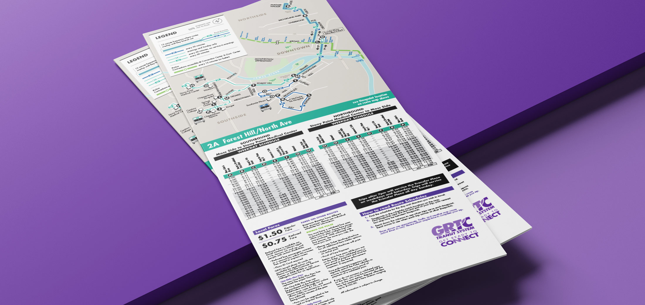
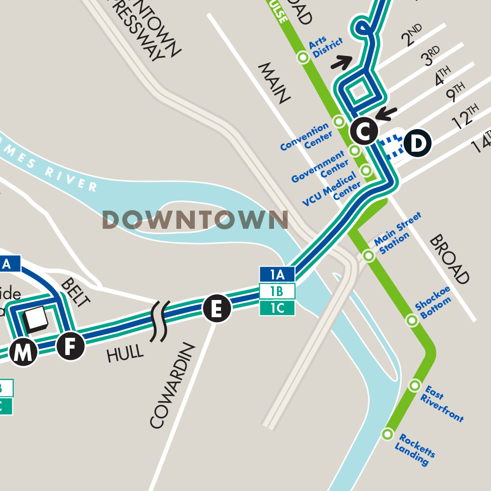
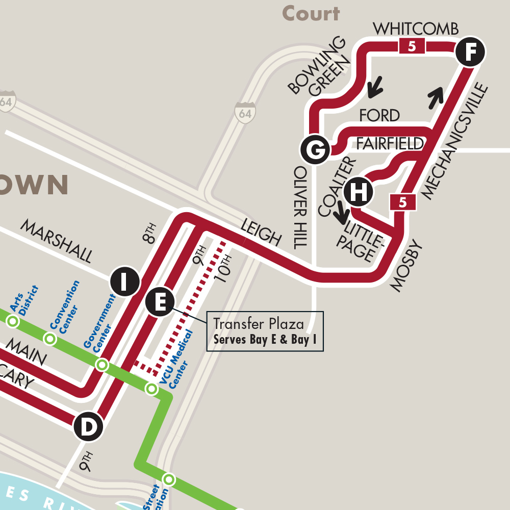
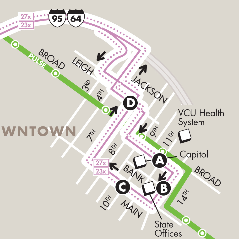
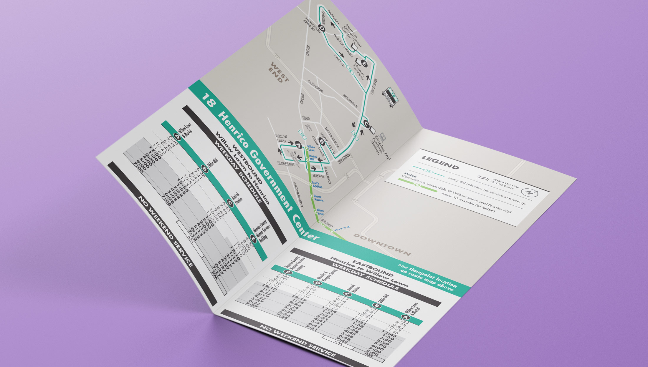
We began by analyzing the Geographic Information Systems (GIS) maps the client supplied. Then, we aligned the style and scale to past GRTC pocketmaps, incorporating the new routes and bus stops. To clearly translate large geographic areas into tiny vectorized maps, segments from different regions were extracted, proportioned and truncated to display only the streets and system of stops relevant to each specific route. Using an organized system of tables, layers and proofing, the new times, stop names and regions were inputted for each individual route. New icons were created to differentiate between the route time intervals, as well as within the legend to identify the irregular daytime and nighttime schedules. Printed in full color, these maps were now ready to equip GRTC riders with the information they needed in a clear cut, coherent format.
Outcome
Upon the unveiling of the Pulse in June of 2018, GRTC was equipped with 38 revamped and restructured maps, each unique and customized to their specific routes and schedules. The logical, polished map and time table design ensured riders a smooth transition to understanding the new bus system and how to visually differentiate between the many variations, laying the groundwork for any additional routes and maps they may add. Whether paper or digital, the maps are a resource, as nomadic and diverse as the riders who carry them in their pockets to their destination.